How should you read an Iran missile range map?
A useful Iran missile range map is not a single static graphic. It is a layered decision tool combining range rings, launcher assumptions, warhead options, and defense density. Most public maps show circles from a central point in Iran, but real launch geography can shift from western, central, or southern areas depending on campaign logic. That means two maps with the same missile label can imply very different target exposure.
For strategic assessment, divide map interpretation into three levels. First, ask whether a target is inside nominal range under ideal conditions. Second, ask whether that target remains inside range after realistic payload and trajectory adjustments. Third, ask whether the strike would matter operationally given warning time, missile defense readiness, and likely retaliatory cost. This is why a map is an entry point, not a conclusion.
This framing aligns with the broader force-structure context in the Iran military strength briefing and the system-by-system references in the Iran weapons systems guide. It also helps readers evaluate claims that treat distance as equivalent to outcome, which is rarely true in missile operations.
| Map layer | What it answers | Common mistake |
|---|---|---|
| Nominal range ring | Could the missile physically reach this area? | Assuming every point in the ring has equal strike probability. |
| Launcher geography | From which launch zone is range being measured? | Using only one origin point for all scenarios. |
| Payload and trajectory | What tradeoffs change practical distance? | Ignoring how payload choices can alter performance. |
| Defense environment | How hard is it to penetrate local defenses? | Treating reach as guaranteed effect. |
How far can Iran missiles reach across range bands?
Open-source assessments generally describe Iran as a regional missile power with broad short-range and medium-range depth. The practical range story begins below 1,000 km, where strike options against nearby military and infrastructure targets are densest. Between roughly 1,000 and 2,000 km, the target set broadens substantially across the Levant and Gulf theaters, and this is where many public debates about countries in range of Iran missiles are concentrated.
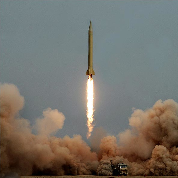
Short-range ballistic missile band (under about 1,000 km)
This band is operationally significant because it supports high-tempo regional pressure and faster warning cycles. It also overlaps with geographically compressed theaters where defense forces must make rapid interception and attribution decisions. In escalatory phases, this range class can be used for signaling, punitive retaliation, or saturation attempts against regional airfields, logistics hubs, and energy nodes.
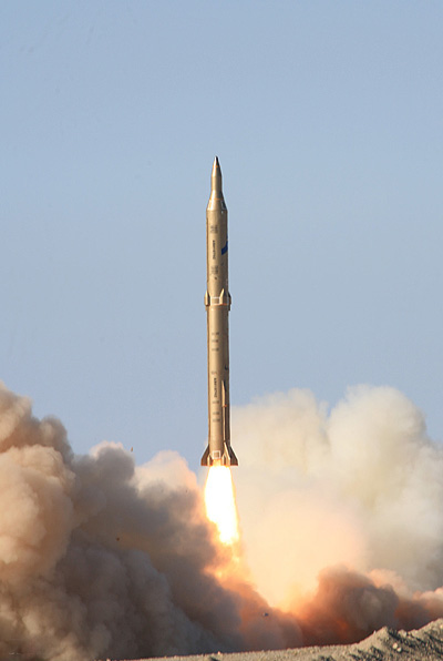
Medium-range ballistic missile band (roughly 1,000-2,000 km)
The medium-range segment is central to Iran missile range by country analysis because it increases the number of relevant military and economic targets. Publicly discussed systems in this category often anchor deterrence messaging. However, maximum range is only one variable; reliability, reentry profile, and target hardness matter just as much when planners estimate actual campaign effect.
Beyond 2,000 km and the ICBM question
Questions like does Iran have ICBM appear frequently in search behavior, but open-source consensus still focuses on regional and near-extra-regional capability rather than clearly fielded intercontinental inventory. Analysts monitor propulsion, staging, and space-launch overlap indicators for long-term trajectory, yet current risk management remains primarily theater-oriented. This distinction prevents both complacency and exaggeration.
Which countries are in range of Iran missiles?
Coverage judgments should be presented as conditional, not absolute. A country can be within theoretical range while many potential targets inside that country remain difficult to service due to defense architecture, basing uncertainty, or escalation costs. With that caveat, country-level mapping still helps decision-makers prioritize force protection and infrastructure resilience.
For illustration, Gulf states close to Iran's southern coast can fall within multiple missile classes, especially when launch points are assumed near the Gulf littoral. Iraq and parts of the eastern Mediterranean are frequently discussed in medium-range scenarios. Israeli targets are commonly modeled in open-source range analyses, though strike success assumptions vary widely across studies and political contexts. Some southeastern European corridors may appear within outer rings depending on the specific system and launch point, but practical mission confidence at those distances is debated.
| Target geography | Typical map treatment | Planning caveat |
|---|---|---|
| Near Gulf region | Inside multiple short/medium rings. | High defense alert levels can alter expected effects. |
| Iraq and nearby corridors | Often inside high-confidence coverage assumptions. | Dispersed targets reduce one-salvo impact. |
| Levant and Eastern Mediterranean | Frequently included in medium-range scenarios. | Political constraints may shape target selection. |
| Outer-ring Europe edges | Sometimes included in maximal-range maps. | Outer-ring inclusion does not equal operational certainty. |
Readers comparing this section with broader posture can cross-reference the Map US military bases Middle East briefing and the US-Iran-Israel triangle strategy analysis. Together, they explain why geographic reach and alliance behavior must be modeled as one system.
What changes strike effectiveness beyond raw distance?
Missile range lists are easy to publish, but campaign effectiveness depends on additional variables that are harder to compress into a headline chart. Accuracy, salvo size, target hardness, decoys, and interceptor readiness all shape final outcomes. A map can indicate where a strike is possible; it cannot by itself indicate whether that strike would produce strategic leverage.
Guidance and terminal performance
Guidance quality has disproportionate value against hardened or time-sensitive targets. A missile that reaches distance but cannot reliably service a hardened military node creates a different risk profile than one optimized for precision at similar range. Public reporting often mixes these categories, which is one reason analysts should keep separate scorecards for range and expected effect.
Salvo logic and defense saturation
Single-missile performance is less relevant than salvo behavior in a real exchange. Defensive systems are designed for layered interception, but capacity and geometry matter. Attack planners might attempt timing and axis combinations to stress defenses; defenders respond with dispersal, deception, and integration across sensors and shooters. This interaction is dynamic, and therefore maps must be updated with force-posture context.
Operational risk is best measured as reach multiplied by survivability and decision speed, not reach in isolation.
Scenario models for Iran missile range map planning
To make map outputs decision-ready, planners should test several scenario families rather than one default projection. Below is a compact model used in policy and risk discussions to distinguish symbolic signaling from operationally consequential attacks. The idea is to link range arcs with intent, not to predict exact conflict sequencing.
| Scenario | Missile employment pattern | Likely objective | Escalation implication |
|---|---|---|---|
| Demonstration salvo | Limited launches with high signaling value. | Show resolve and impose political cost. | Often leaves room for controlled de-escalation. |
| Infrastructure pressure | Targeting logistics or energy nodes in theater. | Increase economic and military friction. | Raises risk of retaliatory strike cycles. |
| Defense-stress attempt | Multiple vectors and timing windows. | Test interceptor and command resilience. | Can rapidly narrow diplomatic off-ramps. |
| Extended coercive campaign | Repeated launches over days. | Sustain pressure on allied decision-making. | Higher probability of broad regional spillover. |
These scenario bands connect directly to the site's Can Iran Attack US risk model and to shipping-centered escalation channels covered in the Strait of Hormuz on a map reference. Missiles, maritime pressure, cyber incidents, and proxy operations usually interact rather than occur as isolated tracks.
When public discussions ask how far can Iran missiles reach us, the better analytic answer is: reach is one filter, but campaign logic is the final determinant of risk to US assets and partners. In other words, the map must be read with doctrine and signaling behavior, not as a stand-alone threat score.
What indicators should you monitor week to week?
A robust Iran missile range map process includes recurring indicators, because missile risk can change materially without a new system announcement. Movement patterns, procurement signals, launch activity, and messaging shifts can all alter perceived readiness and deterrence credibility. Analysts who track leading indicators often detect directional change before major headlines appear.
Operational indicators
Watch for reports of launcher movement, unusual command-network activity, and test cadence anomalies. One isolated indicator is rarely conclusive, but several aligned indicators can signal posture change. This is especially relevant when paired with broader command context from the IRGC headquarters structure briefing.
Diplomatic and signaling indicators
Official statements, military exercises, and coalition messaging can influence perceived launch thresholds even when hardware does not change. Diplomatic friction can raise the probability that maps used for internal planning become externally visible signaling tools.
Defense posture indicators
On the defensive side, shifts in interceptor deployment, readiness drills, and base hardening can change expected strike outcomes. A country moving from peacetime routine to high-alert defense architecture may materially reduce the effect of attacks that are technically in range.
Country-case snapshots: how map interpretation changes by target type
Country-level conclusions become more accurate when analysts separate target types inside each geography. A military airbase, an energy terminal, a civilian airport, and a hardened command node inside the same country can present very different strike feasibility profiles even when all are nominally inside the same range ring. This is why practical map use combines distance with mission complexity and likely defensive posture at the time of crisis.
In Gulf-facing scenarios, short warning times and dense infrastructure can raise operational pressure quickly. However, these same theaters often maintain persistent surveillance and layered missile-defense planning, which can reduce expected campaign effect unless attacks are coordinated in timing and axis. In Levant-oriented scenarios, medium-range coverage may widen target options, but political signaling and coalition response dynamics often constrain strike choices as much as technical limits do. In outer-ring scenarios approaching the edge of public range estimates, uncertainty expands around payload, guidance, and reliability, making risk communication more conditional.
Military facilities versus economic infrastructure
Attacks framed around military targets typically prioritize operational disruption, deterrence signaling, or retaliation narratives. Campaigns framed around economic infrastructure often aim to force market repricing, diplomatic pressure, or insurance shock effects. Because these goals differ, the same missile range map can imply different risk hierarchies depending on which target class is prioritized by decision-makers.
Fixed sites versus mobile and distributed targets
Fixed sites are easier to map and model, but they are not always easier to service in defended environments. Distributed targets can be harder to strike decisively yet easier to pressure over time through repeated, lower-intensity disruption. Analysts should therefore avoid binary labels like “in range†and instead assign confidence tiers that account for defense density, target hardness, and likely salvo composition.
| Case type | Map confidence | Main uncertainty driver | Best analytic response |
|---|---|---|---|
| Near-theater airbase | High nominal confidence | Interception and runway-repair resilience | Model repeat-strike requirement, not one-shot effect. |
| Energy export node | Medium-high | Redundancy and recovery timelines | Estimate economic effect windows separately from kinetic damage. |
| Hardened command facility | Medium | Warhead effectiveness and precision limits | Use conditional probability bands, not deterministic outcomes. |
| Outer-ring strategic target | Low-medium | Payload-range tradeoffs at long distance | Treat as contingency planning, not baseline expectation. |
Applying this case-based method improves communication quality for both public and institutional audiences. It clarifies why two analysts can agree on distance and still disagree on expected effect. It also supports better linkage between missile map analysis, diplomatic signaling, and force-protection priorities, which is essential when events move faster than formal intelligence updates.
FAQ: Iran missile range map
How far can Iran missiles reach?
Open-source estimates generally place Iran's strongest operational reach in short- and medium-range bands across the Middle East. The longest publicly discussed ranges are around 2,000 km, but maximum-distance figures should be read alongside payload, guidance, and defense-interception factors.
Which countries are in range of Iran missiles?
Nearby Gulf states, Iraq, Israel, and parts of surrounding theaters are frequently included in public range maps. Exact coverage varies by missile type and launch location assumptions, so country-level inclusion should be treated as conditional rather than absolute.
Does Iran have an ICBM today?
Public assessments generally characterize Iran as a regional missile power without confirmed deployment of an intercontinental ballistic missile force. Most practical risk analysis remains focused on medium-range systems and theater-level escalation dynamics.
What is Iran's longest-range missile in current discussions?
Analysts often cite systems in the approximate 2,000 km class when discussing Iran longest range missile narratives. Real strategic effect still depends on reliability, warhead configuration, and how those systems are employed in a campaign.
How accurate are Iranian ballistic missiles at long range?
Accuracy estimates vary and are often uncertain in open reporting. In planning practice, analysts model expected outcomes through salvo dynamics, target hardness, and layered air defenses rather than relying on a single precision number.